Measuring tower
Michał Wilde MLB
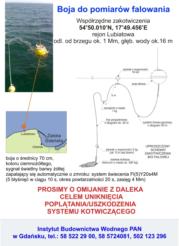
In June 2024, we completed a measuring tower at the depth of about 5 m, some 250 m from the shoreline. The tower is energetically autonomous. The measured data are transmitted by radio and the devices are controlled by radio as well. There is a meteorological station and a camera installed on the tower. Soon, we will equip the tower with a water level and wave sensor. The camera view and results of the measurements will be available on the CRS Lubiatowo web page.