
Instytut Budownictwa Wodnego
Polskiej Akademii Nauk
Polskiej Akademii Nauk
Imię i nazwisko: Szymon Uścinowicz
pokój: A21
tel.: (+48)585222921
e-mail: dc453645e3a2a2bf25d84783b01e4e3ff9bec3ad99c8d9812b4a
ORCID: 0000-0001-6332-8546
Gałka M., Holger- Knorr K., Miotk-Szpiganowicz G., Moskalewicz D., Uścinowicz Sz., Witak M., Woźniak P., 2018 — Uwarunkowania środowiskowe położenia zespołu osadniczego z epoki kamienia w Rzucewie. w: D. Król (red.) Zespół osadniczy z epoki kamienia w Rzucewie, stanowisko 1, gmina Puck”. Muzeum Archeologiczne w Gdańsku, Gdańsk: 14-39.
Miotk-Szpiganowicz G., Uścinowicz Sz., 2018 — Czy Puck zawsze leżał nad wodą? w: M. Milewska, M. Starski (red.) PUCK - przewodnik archeologiczny, w 670. rocznicę lokacji miasta. Puck – Warszawa: 25-28
Rosentau A., Bennike O., Uścinowicz S., Miotk-Szpiganowicz G., 2017 — The Baltic Sea Basin. w: N. C. Flemming , J. Harff, D. Moura , A. Burgess, G. Bailey (red.). Submerged Landscapes of the European Continental Shelf: Quaternary Paleoenvironments. Wiley-Blackwell: 103-133
Harff J., Flemming N., Groh A., Hünicke B., Lericolais G., Meschede M., Rosentau A., Sakellariou D., Uscinowicz S., Zhang W., Zorita E., 2017 — Sea Level and Climate. w: N. C. Flemming , J.Harff, D. Moura , A. Burgess, G. Bailey (red.). Submerged Landscapes of the European Continental Shelf: Quaternary Paleoenvironments . Wiley-Blackwell: 11-49
Miotk Szpiganowicz G., Uścinowicz Sz., 2016 — Historia naturalna Zalewu i Zatoki Puckiej. w: J. P. Dettlaff (red.) Gmina Puck, …rytm życia, nowe perspektywy, BisMedium, Bydgoszcz: 57-66
Jegliński W., Uścinowicz Sz., 2015 — Uwarunkowania geologiczne lokalizacji Twierdzy Wisłoujście (Location and geological setting of Wisłoujście Fortress). w: J. Dąbal, K. Krawczyk, T. Widerski (red.). Gdańsk, Twierdza Wisłoujście. Badania archeologiczno-architektoniczne w latach 2013-2014. (Wisłoujście Fortress, Gdańsk. Archeological and architectural investigations, 2013-2014). Instytut Archeologii I Etnologii, Uniwersytet Gdański, Muzeum Historyczne Miasta Gdańska: 11- 20.
Jegliński W., Uścinowicz Sz., Przezdziecki P., 2014 — The geological structure and evolution of the area around the Copper Ship; Budowa geologiczna i rozwój obszaru w rejonie wraku Miedziowca. w: W. Ossowski (red.). The Copper Ship, a medieval shipwreck and its cargo; Miedziowiec, wrak średniowiecznego statku i jego ładunek. National Maritime Museum in Gdańsk; Narodowe Muzeum Morskie w Gdańsku. Gdańsk: 161-176.
Uścinowicz Sz. 2014 — Baltic Sea Continental Shelf. w: F. Chiocci, A. Chivas (ed.) Continental Shelves of the World, Their Evolution During Last Glacio-Eustatic Cycle. Geological Society Memoir No.41, London: 69-89
Jurys L., Uścinowicz Sz., 2014 — Naturalne i antropogeniczne czynniki kształtujące procesy geologiczne w pasie polskiego brzegu klifowego. w: R. Sokołowski (red.) Ewolucja środowisk sedymentacyjnych regionu Pobrzeża Kaszubskiego. Wydział Oceanografii i Geografii Uniwersytetu Gdańskiego. Gdynia: 27-37
Uścinowicz Sz. (red.), 2011– Geochemia osadów powierzchniowych Morza Bałtyckiego. Państwowy Instytut Geologiczny-Państwowy Instytut Badawczy, Warszawa: 356.
• Rozdział 1. Wprowadzenie: 9-12 (Sz. Uścinowicz)
• Rozdział 2.1. Morze Bałtyckie, jego położenie, podział oraz zlewisko: 13-17. (Sz. Uścinowicz, G. Miotk-Szpiganowicz)
• Rozdział 2.2. Zarys budowy geologicznej zlewiska Morza Bałtyckiego: 17-20. (R. Kramarska, Sz. Uścinowicz)
• Rozdział 4.1. Podłoże czwartorzędu: 66-70. (R.Kramarska, Sz. Uścinowicz)
• Rozdział 4.2. Zarys historii Morza Bałtyckiego: 70-72. (Sz. Uścinowicz)
• Rozdział 4.3. Pokrywa czwartorzędowa: 72-76. (R. Kramarska, G. Miotk-Szpiganowicz, Sz. Uścinowicz )
• Rozdział 4.4. Współczesne osady powierzchniowe i procesy sedymentacyjne: 76-80. (Sz. Uścinowicz)
• Rozdział 6. Składniki główne osadów Morza Bałtyckiego: 164-171. (Sz. Uścinowicz, K. Sokołowski)
• Rozdział 8. Pierwiastki śladowe w osadach Morza Bałtyckiego: 214-274 (Sz. Uścinowicz, P. Szefer, K. Sokołowski)
• Dodatek 2. Geologiczny i geochemiczny monitoring dna Zatoki Gdańskiej: 245-248.
(J. Ebbing, C. Laban, Sz. Uścinowicz)
• Dodatek 3. Projekt MASS – Ocena i monitoring środowiska morskiego Basenu Gdańskiego: 249-252 (Sz. Uścinowicz, J. Ridgway, C. Laban)
• Dodatek 4. Normalizacja danych geochemicznych: 256-258. (Sz. Uścinowicz, P. Szefer, K. Sokołowski)
• Rozdział 9. Trwałe zanieczyszczenia organiczne w osadach Morza Bałtyckiego: 275-291 (I. Bojakowska, Sz. Uścinowicz)
• Rozdział 15. Kilka uwag końcowych: 350-352 (Sz. Uścinowicz, J. Bolałek)
75. Uścinowicz Sz. (sc. ed.), 2011– Geochemistry of Baltic sea surface sediments. Polish Geological Institute – National Research Institute, Warsaw: 356.
• Chapter 1. Introduction: 9-12 (Sz. Uścinowicz)
• Chapter 2.1. The Baltic Sea: Location, Division and Catchment Area: 13-17. (Sz. Uścinowicz, G. Miotk-Szpiganowicz)
• Chapter 2.2. An Outline of the Geological Structure of the Baltic Sea Catchment Area: 17-20. (R. Kramarska, Sz. Uścinowicz)
• Chapter 4.1. The Quaternary Basement: 66-70. (R.Kramarska, Sz. Uścinowicz)
• Chapter 4.2. An Outline of the History of the Baltic Sea : 70-72. (Sz. Uścinowicz)
• Chapter 4.3. Quaternary Cover of the Baltic Sea Bottom: 73-76. (R. Kramarska, G. Miotk-Szpiganowicz, Sz. Uścinowicz )
• Chapter 4.4. Surface Sediments and Sedimentation Processes: 76-80. (Sz. Uścinowicz)
• Chapter 6. Main Constituents of the Baltic sea sediments: 164-171. (Sz. Uścinowicz, K. Sokołowski)
• Chapter 8. Trace Elements in the Baltic Sea Sediments: 214-274 (Sz. Uścinowicz, P. Szefer, K. Sokołowski)
• Appendix 2. Geological and Geochemical Monitoring of the Gulf of Gdańsk: 245-248.
(J. Ebbing, C. Laban, Sz. Uścinowicz)
• Appendix 3. MASS Project – Marine Environment Assesment and Monitoring of the Gulf of Gdańsk Seabed: 249-252 (Sz. Uścinowicz, J. Ridgway, C. Laban)
• Appendix 4. Normalisation of Geochemical Data: 256-258. (Sz. Uścinowicz, P. Szefer, K. Sokołowski)
• Chapter 9. Persistent Organic Pollutants in the Baltic sea Sediments: 275-291 (I. Bojakowska, Sz. Uścinowicz)
• Chapter 15. A Few Final Remarks: 349-351 (Sz. Uścinowicz, J. Bolałek)
Uścinowicz Sz., Miotk-Szpiganowicz G., Krąpiec, M. Witak M., Harff J., Lübke H.,. Tauber F., 2011 – Drowned forests in the Gulf of Gdańsk (Southern Baltic) as an indicator of the Holocene shoreline changes. W: J. Harff, S. Björck, P. Hot (red.) The Baltic Sea Basin. Springer-Verlag, Berlin-Heidelbergr: 221-234.
Miotk-Szpiganowicz G., Uścinowicz Sz., Przezdziecki P., Jegliński W., 2009 –Reconstruction of the paleo-landscapes of the southern Baltic. w: M. Manders, R. Oosting, W. Brouwers (Eds.) MACHU (Managing Cultural Heritage Underwater) Final Report Nr 33. Educom Publisher BV, Rotterdam s. 80-84.
Uścinowicz Sz. Narkiewicz W. Sokołowski K., 2003 — Mineralogical composition and granulometry. w: M Pertila et al. (Eds.) – Contaminants in the Baltic Sea sediments. MERI Report Series of the Finnish Institute of Marine Research, No. 50: 21-24.49.
Zachowicz J. Laban C. Uścinowicz Sz. Ebbing J, Emelyanov E. M., 2002 — Recent sedimentation in the Gulf of Gdańsk and its geochemical expression. w: E., M. Emelyanov (Ed.) Geology of the Gdańsk Basin – Baltic Sea (Monograph). Russian Academy of Sciences, Yantarny Skaz: 380-387.
Kramarska R. Tomczak A. Uścinowicz Sz. Zachowicz J. Pazdur A. Michczyński A. Goslar T., 1999 — Późny plejstocen i holocen polskiego brzegu i polskiej strefy ekonomicznej Bałtyku w świetle statystycznej analizy dat radiowęglowych. w: A. Pazdur i in. (red.) - Geochronologia górnego czwartorzędu Polski w świetle datowania radiowęglowego i luminescencyjnego: 251-263.
Uścinowicz Sz., 2017 — Ewolucja Morza Bałtyckiego w późnym glacjale i w holocenie. w: J. Nawrocki, A. Becker (red.) Atlas geologiczny Polski. Państwowy Instytut Geologiczny – Państwowy Instytut Badawczy, Warszawa: 142.
Uścinowicz Sz., 2017 — Współczesne procesy sedymentacyjne. w: J. Nawrocki, A. Becker (red.) Atlas geologiczny Polski. Państwowy Instytut Geologiczny – Państwowy Instytut Badawczy, Warszawa: 141
Uścinowicz Sz., Kramarska R., 2017 — Zawartość niklu w osadach Morza Bałtyckiego, Zawartość kadmu w osadach Morza Bałtyckiego, Zawartość miedzi w osadach Morza Bałtyckiego. w: J. Nawrocki, A. Becker (red.) Atlas geologiczny Polski. Państwowy Instytut Geologiczny – Państwowy Instytut Badawczy, Warszawa: 131
Jegliński W., Kramarska R., Uścinowicz Sz., Zachowicz J., 2009. Waloryzacja złóz mineralnych. Atlas siedlisk dna polskich obszarów morskich. Brooker-Innowacji, s. 94-95 Gdynia
Jegliński W., Kramarska R., Uścinowicz Sz., Zachowicz J.,: 2009 – Siedliska. Atlas siedlisk dna polskich obszarów morskich. Brooker-Innowacji, s. 90-91 Gdynia
Jegliński W., Kramarska R., Uścinowicz Sz., Zachowicz J., 2009 – Osady. Atlas siedlisk dna polskich obszarów morskich. Brooker-Innowacji, s. 28-29 Gdynia
Bobertz B., Harff J., Lemke W., Uścinowicz Sz., Kramarska R., Zachowicz J., Przezdziecki P. 2006 – Surface Sediments of the South-Western Baltic Sea , 1:250000, Państwowy Instytut Geologiczny & Institute für Ostseeforschung Warnemünde, Gdańsk.
Uścinowicz Sz. (współautor) – 1997 Bathymetric map of the Central Baltic Sea, 1:500000. 1998 — Ed. L. Z. Gelumbauskaite. Lithuanian Geological Institute, Geological Survey of Lithuania, Geological Survey of Sweden, Swedish Maritime Administration. Vilnius, Uppsala.
Uścinowicz Sz. (współautor) – 1997 Bottom sediment map of the Central Baltic Sea, 1:500000. 1998 — Ed. M. Repecka, I. Cato. Lithuanian Geological Institute, Geological Survey of Lithuania, Geological Survey of Sweden, Swedish Maritime Administration. Vilnius, Uppsala.
Uścinowicz Sz., Zachowicz J. 1996 — Atlas geochemiczny Zalewu Wiślanego. Państw. Inst. Geol. Warszawa: Tab. I-XXXVIII: 1-14.
Mojski J.E., Dadlez R., Słowańska B., Uścinowicz Sz., Zachowicz J. (red.), 1995 —Atlas geologiczny południowego Bałtyku. Państw. Inst. Geol. Sopot–Warszawa: 1-63, Tab. I – XXXIV.
• Miąższość czwartorzędu (Tab. XIII) – Sz. Uścinowicz
• Miąższość plejstocenu (Tab. XIV) – Sz. Uścinowicz
• Osady plejstoceńskie (Tab. XV) – Sz. Uścinowicz
• Miąższość holocenu (Tab. XXIII) – Sz. Uścinowicz
• Przekroje geologiczne I, II (Tab. XIX, XX) – R. Kramarska, P. Przezdziecki, Sz. Uścinowicz, J. Zachowicz.
• Ewolucja południowego Bałtyku w późnym glacjale i holocenie (Tab. XXVII) – Sz. Uścinowicz
• Współczesne procesy sedymentacyjne (Tab. XXVIII) – Sz. Uścinowicz
• Czwartorzęd (s. 22-30) – R. Kramarska, Sz. Uścinowicz, J. Zachowicz.
• Współczesne procesy sedymentacyjne (s. 51-55) – Sz. Uścinowicz
Emelyanov E. Neuman G. Lemke W. Kramarska R. Uścinowicz Sz., 1994 — Bottom sediments of the western Baltic. Head Department of Navigation and Oceanography, Russian Federation Ministry of Defense, Sankt Petersburg.
Emelyanov E. Neuman G. Harff J. Kramarska R. Uścinowicz Sz., 1994 — Quaternary deposits of the western Baltic. Head Department of Navigation and Oceanography, Russian Federation Ministry of Defense, Sankt Petersburg.
Szczepańska T. Uścinowicz Sz., 1994 — Atlas geochemiczny południowego Bałtyku. Państw. Inst. Geol. Warszawa. Tab. I-X: 1-55.
Uścinowicz Sz. Zachowicz J., 1994 — Objaśnienia do mapy geologicznej dna Bałtyku 1:200000, arkusze: Gdańsk, Elbląg, Głębia Gdańska. Państw. Inst. Geolog. Warszawa: 1-65.
Uścinowicz Sz., Zachowicz J., 1993 — Mapa Geologiczna Dna Bałtyku, 1:200 000, ark. Głębia Gdańska. Państw. Inst. Geol. Warszawa.
Uścinowicz Sz., Zachowicz J., 1993 — Mapa Geologiczna Dna Bałtyku, 1:200 000, ark. Gdańsk. Państw. Inst. Geol. Warszawa.
Uścinowicz Sz. Zachowicz J., 1993 — Mapa Geologiczna Dna Bałtyku, 1:200 000, ark Elbląg. Państw. Inst. Geol. Warszawa.
Uścinowicz Sz., Zachowicz J., 1993 — Mapa Geologiczna Dna Bałtyku, 1:200 000, ark. Rønne-Nexø. Państw. Inst. Geol. Warszawa.
Uścinowicz Sz., Zachowicz J., 1992 — Objaśnienia do mapy geologicznej dna Bałtyku 1:200000, arkusz Rønne-Nexø. Państw. Inst. Geol. Warszawa: 1-38.
Uścinowicz Sz. Zachowicz J., 1991 — Mapa Geologiczna Dna Bałtyku, 1:200 000, ark. Łeba, Słupsk. Państw. Inst. Geol., Warszawa.
Uścinowicz Sz., Zachowicz J., 1991 — Objaśnienia do Mapy Geologicznej Dna Bałtyku, 1:200 000, ark. Łeba, Słupsk. Państw. Inst. Geol., Warszawa: 1-55.
Uścinowicz Sz., 1989 — Mapa Geologiczna Dna Bałtyku, 1:200 000, ark. Kołobrzeg. Państw. Inst. Geol., Warszawa.
Uścinowicz Sz., 1989 — Objaśnienia do Mapy Geologicznej Dna Bałtyku, 1:200 000, ark. Kołobrzeg. Państwowy Instytut Geologiczny, Warszawa: 1-58.
Rosentau A., Klemann V., Bennike O., Steffen H., Wehr J., Latinovi M., Bagge M., Ojala A., Berglund M., Becher G. P., Schoning K., Hansson A., Nielsen L, Clemmensen L. B., Hede l M. U., Kroon A., Pejrup M., Sander L., Stattegger K., Schwarzer K., Lampe R., Lampe M., Uścinowicz Sz., Bitinas A., Grudzinska I., Vassiljev J., Nirgi T., KublitskiyY., Subetto D., 2021 — A Holocene relative sea-level database for the Baltic Sea. Quaternary Science Reviews, Vol. 266.
https://doi.org/10.1016/j.quascirev.2021.107071
Zglinicki K., Uścinowicz Sz., Łęczyński L., Szamałek K., Jegliński W., Pączek U., Bylina P., Banaś M., 2021 — Konkrecje Fe-Mn z polskiego sektora Morza Bałtyckiego– stan wiedzy i potrzeba badań. Przegląd Geologiczny, Vol. 69, nr 3: 161- 168. doi.org/10.7306/2021.10
Uścinowicz Sz, Adamiec G, Bluszcz A, Jegliński W and Miotk-Szpiganowicz G., 2021 — Holocene development of the Vistula Spit (Baltic Sea coast) based on multidisciplinary investigations. The Holocene 31(4):658–671. DOI: 101177/0959683620983410
Uścinowicz Sz, Witak M., Miotk-Szpiganowicz G., Burska D., Cieślikiewicz W., Jegliński W., Jurys L., Sydor P., Pawlyta J., Piotrowska N. 2020 — Climate and sea level variability on a centennial time scale over the last 1500 years as inferred from the Coastal Peatland of Puck Lagoon (southern Baltic Sea). The Holocene Vol. 30 (12): 1801-1816. DOI: 10.1177/0959683620950451
Kaskela AM ; Kotilainen, AT; Alanen, U; Cooper, R; Green, S; Guinan, J; Heteren, S; Kihlman, S; Van Lancker, V; Stevenson, A .Uścinowiccz Sz, et al. 2019 — Picking Up the Pieces Harmonising and Collating Seabed Substrate Data for European Maritime Areas. Geosciences Vol. 9 (2): 1-18.
Uścinowicz Sz., Adamiec G., Bluszcz A. ., Jegliński W., Jurys L., Miotk-Szpiganowicz G., Moska P., Pączek U., Piotrowska P., Poręba G., Przezdziecki P., Uścinowicz G. 2019 — Chronology of the last ice sheet decay on the southern Baltic area based on dating of glaciofluvial and ice-dammed lake deposits. Geological Quarterly, 63 (1): 192-207. DOI: http://dx.doi.org/10.7306/gq.1453
Szamałek K., Uścinowicz Sz., Zgliniecki K., 2018 — Rare earth elements in Fe-Mn nodules from southern Baltic Sea – preliminary study (Pierwiastki ziem rzadkich w konkrecjach Fe-Mn z południowego Bałtyku – badania wstępne). Biuletyn PIG Nr 472: 199-212.
Uścinowicz Sz., 2016 — Charakterystyka wpływu środowiska naturalnego na stan zachowania podwodnego stanowiska archeologicznego „pucki port średniowieczny”. Zapiski Puckie, Zeszyt Nr 15. Muzeum Ziemi Puckiej: 23-38.
Kramarska R., Jegliński W., Kaulbarsz D., Pączek U., Przezdziecki P., Bojakowska I., Koszka-Maroñ D., Relisko-Rybak J., Uścinowicz Sz., 2016 — Czwartorzęd Zatoki Pomorskiej i perspektywy surowcowe. Przegląd Geologiczny, vol. 64, nr 8: 552–563.
Pomian I., Śliwiński B., Uścinowicz Sz., Ważny T., 2016 — The Remains of the Medieval Harbour in Puck (Northern Poland): A few Words about the Previous Research Results. Archaeologia Baltica, Vol. 23: 233-241.
Graniczny M., Čyžienė J., van Leijen F., Minkevičius V., Mikulėnas V., Satkūnas J., Przyłucka M., Kowalski Z., Uścinowicz Sz., Jegliński W., Hanssen R., 2015 — Vertical ground movements in the Polish and Lithuanian Baltic coastal area as measured by satellite interferometry. Baltica 28, Vol. 2: 65-80.
Uścinowicz Sz., Jegliński W., Miotk-Szpiganowicz G., Nowak J., Pączek U., Przezdziecki P., Szefler K., 2014 — Impact of sand extraction from the bottom of the southern Baltic sea on the relief and sediments of the seabed. Oceanologia No. 56 (4): 1-24.
Uścinowicz Sz., Miotk-Szpiganowicz G., Gałka M., Pawlyta J., Piotrowska N., Pomian I., Witak M., 2011 (2013) – The rise, development and destruction of the medieval port in Puck in the light of palaeoclimatic and sea level changes research. Archaeologia Polona, Vol. 49: 87-104.
Czarnogórska M., Granicznym., Uścinowicz Sz., Nutricato R., Triggiani S., Nitti D. O., Bovenga F., Wąsowski J., 2012 — Analiza deformacji powierzchniowych wzdłuż południowo-zachodnich wybrzeży Zatoki Gdańskiej z zastosowaniem satelitarnych danych interferometrycznych. Przegląd Geologiczny, vol. 60, nr 4: 147-151.
Graniczny. M., Bovenga F., Kowalski Z., Perski Z., Piatkowska A., Surała M., Uścinowicz Sz., Wasowski J., Zdanowski A., 2011 — Problematyka wykorzystania interferometrii satelitarnej w badaniach geologicznych. Biuletyn Państwowego Instytutu Geologicznego Nr 446 (1): 53- 64.
Leipe T., Tauber F., Vallius H., Virtasalo J., Uścinowicz Sz., Kowalski N., Hille S., Myllyvirta T., 2011 - Particulate organic carbon (POC) in surface sediments of the Baltic Sea. Geo-Marine Letters, 31 (3): 175-188.
Miotk-Szpiganowicz G., Zachowicz J., Uścinowicz Sz., 2010 - Palynological evidence of human activity on the Gulf of Gdańsk coast during the Late Holocene. Brazilian Journal of Oceanography, 58 (special issue, IGCP526):1-13.
Miotk-Szpiganowicz G., Zachowicz J., Uścinowicz Sz., 2008 – Review and reinterpretation of the pollen and diatom data from the deposits of the southern Baltic lagoons. Polish Geological Institute Special Papers, Vol. 23: 45-70.
Zachowicz J., Miotk-Szpiganowicz G., Kramarska R., Uścinowicz Sz., Przezdziecki P., 2008. – A critical review and reinterpretation of bio-, litho- and seismostratigraphic data of the southern Baltic deposits. Polish Geological Institute Special Papers Vol. 23, 117-138.
Miotk-Szpiganowicz G., Zachowicz J., Uścinowicz Sz., 2007 – Nowe spojrzenie na rozwój zbiorników przybrzeżnych południowego Bałtyku. Limnologica et Telmatologica 1:1-10.
Łęczyński L., Miotk-Szpiganowicz G., Zachowicz J., Uścinowicz Sz., Krąpiec M. 2007 – Tree stumps from the bottom of the Vistula Lagoon as indicators of water level changes in the Southern Baltic during the Late Holocene. Oceanologia, 49 (2): 245-257.
Uścinowicz Sz., Zachowicz J., Miotk-Szpiganowicz G., Witkowski A. 2007 – Southern Baltic sea-level oscillations: New radiocarbon, pollen and diatom proof of the Puck Lagoon. in: Coastline changes: Interrelation of climate and geological processes (eds. J. Harff, W. W. Hay, D. M. Tetzlaff). Geol. Soc. of Am. Special Paper 426: 143-158.
Piechura J., Pempkowiak J., Radziejewska T., Uścinowicz Sz., 2006 – What we know abort the Baltic Sea: a Sumary of BSSC 2005. Oceanologia, 48 (S): 3-19.
Uścinowicz Sz. 2006. — A relative sea-level curve for Polish Southern Baltic Sea. Quaternary International, Vol. 145-146: 86-105.
Uścinowicz Sz. 2005 — Zmiany linii brzegowej południowego Bałtyku w późnym glacjale i holocenie. w: J. Skoczylas (red.). Referaty Tom XIV. Uniwersytet im. Adama Mickiewicza, Instytut Geologii, Polskie Towarzystwo Geologiczne Oddział w Poznaniu. Poznań: 77-90.
Uścinowicz Sz., Zachowicz J. 2005 — Terrestrial deposits from the Słupsk Bank as an evidence of the Late Glacial and Early Holocene Baltic Sea level. Polish Geological Institute Special Papers, 16: 133–141.
Graniczny M. Janicki T. Kowalski Z. Uścinowicz Sz. Zachowicz J., 2004 — Geoindykatory strefy brzegowej — rejestracja i analiza procesów i zjawisk. Przegląd Geologiczny vol. 52, nr 1: 47-54.
Uścinowicz Sz. 2004: Rapid sea level changes in the southern Baltic during Late Glacial and Early Holocene. Polish Geological Institute Special Papers Vol.11: 9-18.
Uścinowicz Sz., Zachowicz J., Graniczny M., Dobracki R., 2004 — Geological structure of the southern Baltic coast and related hazards. Polish Geological Institute Special Papers Vol.15: 61-68.
Kramarska R., Masłowska M.,. Uścinowicz Sz., Zachowicz J., 2004 — Review of marine sand and gravel resourcres in the Polish Exclusive Economic Zone of the Baltic Sea. Zeitschrift Fur Angewandte Geologie. Sonderheft 2: 125-134
Graniczny M., Janicki T., Kowalski Z., Koszka-Maroń D., Jegliński W., Uścinowicz Sz., Zachowicz J., 2004 — Recent development of the Vistula River outlet. Polish Geological Institute Special Papers Vol.11: 103-108.
Bojanowski R. Radecki Z. Uścinowicz Sz. Knapińska-Skiba D., 2003 — Penetration of caesium–137 into sandy sediments of the Baltic Sea. Proceedings of the Baltic Marine Sciences Conference. ICES Cooperative Research Report No. 257: 85-89.
Uścinowicz Sz. Miotk-Szpiganowicz G., 2003: Holocene Shoreline Migration in the Puck Lagoon (Southern Baltic Sea) based on the Rzucewo Headland case study. Landform Analysis Vol. 4: 81–95.
Kramarska R. Uścinowicz Sz. Zachowicz J., 2002 — Kenozoik południowego Bałtyku wybrane zagadnienia. Przegląd Geologiczny, Nr 8: 709-716.
Ebbing J., Zachowicz J., Uścinowicz Sz., Laban C., 2002 — Normalisation as a tool for environnmental impact studies: the Gulf of Gdańsk as a case study. Baltica 15: 49–62.
Uścinowicz Sz. Zachowicz J. Sokołowski K., 2000 — The potential impact of a sewage discharge through the „Gdańsk-Wschód” sewage-treatment plant collector on the Gulf of Gdańsk sediments. Oceanological Studies Vol. XXIX, No. 4: 67-82.
Uścinowicz Sz., Kramarska R., Tomczak A., Zachowicz., 2000 — The radiocarbon age of marine and land deposits in the Southern Baltic area. Geologos 5: 155-163.
Uścinowicz Sz., 1999 — Southern Baltic area during the last deglaciation. Geological Quarterly, 43(2): 137-148.
Uścinowicz Sz. Ebbing, J. Laban C. Zachowicz J., 1998 — Recent muds of the Gulf of Gdańsk. Baltica Vol. 11, s. 25-32.
Uścinowicz Sz., 1997 — Basen Gdański. Przegląd Geologiczny. Vol. 45, Nr 6: 589-594.
Passhier S., Uścinowicz Sz., Laban C., 1997: Sediment supply and transport directions in the Gulf of Gdańsk as observed from SEM analysis of quartz grain surface textures. Prace Państwowego Instytutu Geologicznego CLVIII,: 1-23.
Glasby G. P., Uścinowicz Sz., Sochan J. A., 1996 — Marine ferromanganese concretions from Polish Exclusive Economic Zone: Influence of major inflows of North Sea water. Marine Georesources and Geotechnology, 14: 335-352.
Uścinowicz Sz., 1996 — Deglacjacja obszaru południowego Bałtyku. Biuletyn PIG 373: 177-193.
Kramarska R. Uścinowicz Sz. Zachowicz J, 1995 — Origin and evolution of the Puck Lagoon. Journal of Coastal Research, Special Issue, No. 22: 187-191.
Gajewski L. Uścinowicz Sz., 1993 — Hydrologic and sedymentologic aspects of mining aggregate from Słupsk Bank. Marine Georesources and Geotechnology, vol. 11: 229-244.
Uścinowicz Sz., 1992 — Environmental aspects of mining clastic material from the sea bottom. w: H. Sterr, J. Hofstede, H-P. Plag (eds.) Proceedings of the International Coastal Congress ICC- Kiel’92. Peter Lang, Frankfurt am Main, Berlin, Bern, New York, Paris, Wien: 648-650.
Jankowska H. Rudowski S. Uścinowicz Sz., 1992 — Sejsmoakustyczne badania dna Zatoki Gdańskiej. Przegląd Geofizyczny, XXXVII, z. 1-2: 61-65.
Gajewski L. Uścinowicz Sz., 1991 — Hydrologiczne i sedymentologiczne aspekty eksploatacji kruszywa na Ławicy Słupskiej. Inżynieria Morska i Geotechnika, 4: 146-153.
Kramarska R. Masłowska M. Michałowska M. Pikies R. Śliwiński Z. Tomaczak A. Uścinowicz Sz. Zachowicz J., 1990 — Termoluminescencyjne wskaźniki wieku osadów plejstoceńskich z dna południowego Bałtyku. Zeszyty Naukowe Politechniki Śląskiej. Matematyka – Fizyka. z. 61, Geochronometria Nr 6: 229-238.
Kramarska R. Masłowska M. Michałowska M. Pikies R. Śliwiński Z. Tomaczak A. Uścinowicz Sz. Zachowicz J., 1990 — Pozycja geologiczna osadów plejstoceńskich z dna Bałtyku Południowego datowanych metodą termoluminescencyjną. Przegląd Geologiczny. Nr 5/6: 248-253.
Przeździecki P. Uścinowicz Sz., 1989 — Nowe dane o rozwoju rzeźby dna południowej części Basenu Bornholmskiego. Studnia i Materiały Oceanologiczne, 56, Geologia Morza 4: 123-129.
Uścinowicz Sz. Kramarska R. Przezdziecki P., 1988 — The Quaternary of the south–west region of the Polish Baltic. w: B. Winterhalter (red.), The Baltic Sea . Geological Survey of Finland, Special Paper, 6: 31-37.
Uścinowicz Sz., 1985 — Litodynamika podwodnego skłonu brzegowego na odcinku Mrzeżyno – Rowy. Przegląd Geologiczny. nr 12: 683-688.
Michałowska M. Uścinowicz Sz., 1985 — Morfologia ziarn kwarcu osadów piaszczystych Bałtyku Południowego. Biuletyn IG. 352: 89-119.
Uścinowicz Sz., 1984 — Uwagi o granulometrii i genezie osadów piaszczysto–mulistych w południowej części Basenu Bornholmskiego. Kwartalnik Geologiczny. T. 28, nr 1: 177-186.
Śliwiński Z. Uścinowicz Sz., 1983 — Litologia osadów powierzchniowych południowej części Basenu Bornholmskiego Kwartalnik Geologiczny T. 27, nr 3: 631-644..
Michalowska M. Uścinowicz Sz., 1983 — Obtoczenie i charakter powierzchni ziarn kwarcu w glinach zwałowych i piaskach morskich rejonów Dziwnowa i Zatoki Gdańskiej. Przegląd Geologiczny nr 10: 538-542.
Kotliński R. Uścinowicz Sz., 1980 — Struktury sedymentacyjne powierzchni dna wybranych rejonów południowego Bałtyku. Kwartalnik Geologiczny. T. 24, nr 2: 377-394.
Uścinowicz Sz., 1980 — Obróbka ziarn powierzchniowych osadów piaszczystych w rejonie Zatoki Koszalińskiej. Zeszyty Naukowe BiNoZ, UG, Oceanografia nr 7: 55-68.
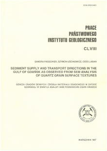 Passchier S., Uścinowicz S., Laban C.
Sediment supply and transport directions in the Gulf of Gdańsk as observed from SEM analysis of quartz grain surface textures
wydawca:
ISBN:
rok wydania: 1997
język: en
Streszczenie: Analizy mikrorzeźby powierzchni ziarn kwarcu wykonano dla 20 próbek, w tym z klifu w Orłowie pobrano pięć próbek reprezentujących mioceńskie iły i piaski oraz dwie warstwy glin zwałowych i piaski fluwioglacjalne. Z Wisły pobrano trzy próbki piasków, a z Zatoki Gdańskiej – 12 próbek. Wszystkie próbki zostały przesiane przez sito 0.063 mm. Z każdej próbki wybrano losowo 35 ziaren, a następnie dla każdego ziarna określono obecność lub brak jednego z 40 parametrów określających obtoczenie i teksturę powierzchni. Zbiór obserwacji (20 próbek), 35 ziaren w próbce i 40 zmiennych) przeanalizowano za pomocą analizy dyskryminacyjnej i czynnikowej. Próbki z klifu i próbki z Wisły posłużyły jako dwa końcowe elementy analizy określające obszary źródłowe osadów. Próbki z rdzeni osadów z Zatoki zostały podzielone na grupy związane z jednym z dwóch głównych obszarów źródłowych. Określono rozmieszczenie w zachodniej części Zatoki Gdańskiej materiału rzecznego Wisły oraz materiału erodowanego z klifów. Wyniki pokazują, że transport frakcji piaszczystej nie jest zbyt intensywny i ma ograniczony zasięg. Pomimo obecności prądów wzdłuż brzegowych sedymentacja w pobliżu ujścia Wisły jest zdominowana przez dopływ materiału rzecznego. W najbardziej na zachód wysuniętej części Zatoki dominuje materiał erodowany z klifu z domieszkami materiału innego pochodzenia. Występują domieszki ziaren wykazujących cechy powierzchni powstałe podczas transportu w środowisku wodnym. Domieszki osadów z innych źródeł mogły być dostarczane przez fale i prądy podczas sztormów oraz na krach podczas ciężkich zim, jednak dominują składniki lokalne.
 Uścinowicz Sz.
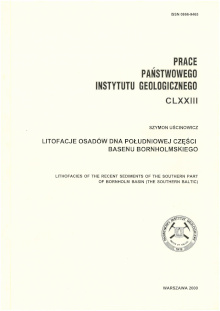
Litofacje osadów dna południowej części Basenu Bornholmskiego
wydawca: Państwowy Instytut Geologiczny - Państwowy Instytut Badawczy
ISBN:
rok wydania: 2000
język: pl
Streszczenie: W pracy przedstawiono analizę litofacjalną współczesnych osadów Morza Bałtyckiego z obszaru południowej części Basenu Bornholmskiego. Na podstawie uziarnienia osadów wyróżniono cztery litofacje: A (żwiry, żwiry piaszczyste, piaski żwirowe, piaski różno-, grubo- i średnioziarniste), B (piaski drobnoziarniste), C (piaski drobnoziarniste i muliste), oraz D (muły piaszczyste, muły, muły ilaste, iły muliste). Przedstawiono ich charakterystykę podając typowe cechy uziarnienia, zawartości minerałów ciężkich, składu mineralno-petrograficznego i obtoczenia ziarn kwarcu. Określono prawidłowości poziomego i pionowego następstwa litofacji na badanym obszarze. Przedstawiono litodynamiczną i genetyczną interpretację cech litofacjalnych oraz podjęto próbę odtworzenia warunków ich powstawania, w powiązaniu ze współczesnymi warunkami hydrodynamicznymi południowego Bałtyku.
 Uścinowicz Sz.
Relative sea level changes, glacio-isostatic rebound and shoreline displacement in the Southern Baltic
wydawca: Państwowy Instytut Geologiczny - Państwowy Instytut Badawczy
ISBN:
rok wydania: 2003
język: en
Streszczenie: Krzywą względnych zmian poziomu morza skonstruowano na podstawie 314 dat radiowęglowych osadów pochodzących z różnych środowisk lądowych i morskich. Próbki do datowań pobrano z 163 stanowisk zlokalizowanych na obszarze polskiej części południowego Bałtyku i przyległej strefy brzegowej. Przy konstruowaniu krzywej wykorzystano również relikty różnych form związanych z rozwojem strefy brzegowej oraz zasięgi powierzchni erozyjnych, zlokalizowane na profilach sejsmoakustycznych. W późnym plejstocenie i wczesnym holocenie, między 13,0 i 8,5 tys. lat BP, poziom wody trzykrotnie wzrastał i opadał, a zakres wahań dochodził do 25-27 m. Poziom wody obniżał się w skrajnych przypadkach w tempie do ok. 100-300 mm/rok, a tempo wzrostu dochodziło do ok. 35-45 mm/rok. W późnym boreale, ok. 8,5 tys. lat BP, Bałtyk uzyskał stałe połączenie z oceanem na poziomie niższym od obecnego o ok. 28 m. Do początku okresu atlantyckiego poziom morza wzrósł do ok. 21 m poniżej współczesnego poziomu morza (p.p.m.). W okresie 8,0-7,0 tys. lat BP poziom morza wzrósł do 10 m p.p.m., w średnim tempie ok. 10 mm/rok. Do końca okresu atlantyckiego poziom morza wzrósł do 2,5 m p.p.m., a tempo wzrostu zmalało do ok. 2,5 mm/rok. W pierwszym tysiącleciu okresu subborealnego poziom wody wzrósł do ok. 1,1-1,3 m, a do końca tego okresu do ok. 0,6-0,7 m niższego niż współczesny. W okresie subatlantyckim średni poziom morza zmienił się już nieznacznie. Przebudowa glaciizostatyczna rozpoczęła się ok. 17,5 tys. lat BP i zakończyła ok. 9,2-9,0 tys. lat BP. Całkowity zakres podniesienia (total uplift) w tym okresie wyniósł ok. 120 m. Maksimum prędkości ruchów wznoszących, dochodzące od ok. 45 mm/rok, wystąpiło w okresie ok. 12,4-12,2 tys. lat BP. W okresie od ok. 9,0 do ok. 7,0 tys. lat BP przez obszar południowego Bałtyku migrowało nabrzmienie brzeżne, a w okresie od ok. 7,0 do ok. 4,0 tys. lat BP wystąpiły ruchy obniżajace. Od ok. 4,0 tys. lat BP położenie skorupy ziemskiej wróciło do stanu równowagi. Linia brzegowa południowego Bałtyku w późnym plejstocenie i wczesnym holocenie kilkukrotnie uległa szybkim i znacznym przemieszczeniom. Zmieniła położenie w tempie od kilkudziesięciu metrów do kilku kilometrów rocznie. Procesy te rozgrywały się na powierzchni dna morskiego położonej obecnie na głębokości od ok. 55 do 25 m p.p.m. i w odległości 30-60 km od dzisiejszego wybrzeża. W środkowym holocenie linia brzegowa przemieściła się ku południowi od ok. 60 km w Zatoce Pomorskiej do ok. 5 km w Zatoce Gdańskiej. Położenie linii brzegowej zbliżyło się do współczesnego w końcu okresu atlantyckiego. W późnym holocenie dominowały procesy wyrównywania wybrzeży, a linia brzegowa stopniowo zbliżała się do obecnego położenia.
 Uścinowicz S.
Geochemia osadów powierzchniowych Morza Bałtyckiego
wydawca: Państwowy Instytut Geologiczny - Państwowy Instytut Badawczy
ISBN: 9788375388138
rok wydania: 2011
język: pl
Streszczenie: Książka „Geochemia osadów powierzchniowych Morza Bałtyckiego” jest odpowiedzią na zapotrzebowanie społeczne, skierowaną nie tylko do specjalistów zajmujących się Morzem Bałtyckim ale również do szerokiego grono czytelników interesujących się naukami o Ziemi. Zawiera nie tylko omówienie składu chemicznego osadów i zmian jakie zaszły w ostatnim stuleciu, ale również wszechstronną analizę procesów i wzajemnych relacji pomiędzy różnymi częściami składowymi środowiska morskiego: wodami, osadami i organizmami bytującymi na dnie. Geochemia osadów morskich jest dziedziną wyjątkową, łączącą w sobie wiele dyscyplin nauki m. in. sedymentologię, mineralogię, chemię, biologię, i oceanografię. Dlatego też z uwagi na różnorodność poruszanych zagadnień, książka „Geochemia osadów powierzchniowych Morza Bałtyckiego” jest dziełem zbiorowym, napisanym przez zespół autorów z Państwowego Instytutu Geologicznego – Państwowego Instytutu Geologicznego, Uniwersytetu Gdańskiego i Gdańskiego Uniwersytetu Medycznego. Dzięki współpracy specjalistów z różnych dziedzin, geologów, oceanografów, geochemików możliwa stała się synteza polskich osiągnięć w badaniach osadów Morza Bałtyckiego, przedstawiona na szerokim tle prac badawczych naukowców z innych krajów nadbałtyckich. Książka jest bogato ilustrowana co ułatwia czytelnikowi zrozumienie skomplikowanych zjawisk zachodzących w środowisku morskim.
 Uścinowicz Sz.
Geochemistry of Baltic sea surface sediments
wydawca: Państwowy Instytut Geologiczny - Państwowy Instytut Badawczy
ISBN: 9788375388145
rok wydania: 2011
język: en
Streszczenie: